Pohnpei Reef Imaging
The Conservation Society of Pohnpei (CSP) supports the state Department of Land and Natural Resources to conduct annual coral reef biological monitoring. Since the establishment of Pohnpei State permanent monitoring stations in 2004, the partners have created a team that looks at food fish species, invertebrates, and benthic habitat change over time at these sites. Through the partnership with OneReef, they have been able to use cutting edge 3D imaging technology to take coral reef monitoring to the next level!
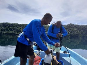
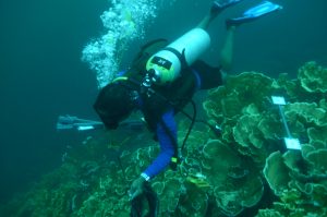
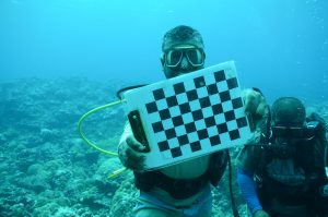
In March 2019, OneReef invited the CSP Marine Team to an underwater imaging training in Palau through its partnership with Scripps Institution of Oceanography. Mr. Kesdy Ladore, CSP Marine Program Manager, led his Team that included Kirino Olpet and Douglas Kusto at the weeklong underwater imaging in Palau. Dr. Stuart Sandin and his assistant, Mr. Brian Zgliczynski, conducted the training that involved classroom presentation, land-based scenario, and actual underwater imaging in the Rock Islands Southern Lagoon of Palau. After the training, Mr. Ladore said, “this imaging technology is a game-changer for coral reef monitoring. The imaging helps us see real change in benthic habitat over time, and it makes it easier for us to communicate those changes to our communities and leadership. With the help of these images, the community can witness these changes and make policies that will help manage our reefs into the future.”
 In June 2020, the Pohnpei State Marine Team and CSP adopted the Micronesia Challenge Marine Monitoring Protocol and the Underwater Imaging Technology to enhance their monitoring. The Team completed the monitoring and imaging of eight (8) sites – Pwukihn Dawahk, Pingda 7, Mwahnd Outer reef, Madamiken, Nan Wap Outer reef, Nahnipwil, Kehpara, and Pelien Mereui, located on the outer reef on Pohnpei’s main island. With the help of GPS unit markers, the Team will reimage these sites in the future. Mr. Angel Jonathan, who works with CSP as its Education and Awareness Officer and assists OneReef in coordinating its activities with community partners, expressed his excitement to see the images and revisit the sites next year to compare changes over time. He is awaiting the results next year and firmly believes that the results will help him communicate changes in the Pohnpei State coral reefs to the communities, youth, and policymakers.
 Koror State Iconic Reefs Imaging
In early October of this year, team members from Helen Reef Resource Management and OneReef Micronesia office began imaging the famous iconic dive and snorkeling site in the Koror State Southern Lagoon, Palau’s first and only World Heritage Site! Mr. Wayne Andrew, Senior Advisor of the OneReef Micronesia Program with Mr. Andrew Tobias Andrew, Flave Andy, and Kenray Torres, imaged six sites – the Jake Seaplane, Soft Coral Arch Snorkeling Site, Cemetery Reef Snorkeling Site, St. Cardinal Dive Site, Million Dollar Channel, and Nikko Bay. In collaboration with OneReef, the Helen Reef staff Rangers were one of the three island teams trained in 2019 by Scripps Institution of Oceanography to use cutting edge 3D imaging technology. This technology allows imaging coral reefs to track reef health over time and use that information to modify conservation plans. The Team will continue imaging the outer lagoon sites, including Big Drop Off, Blue Hole, and the many other dive sites in the Koror Southern Lagoon.
Two important outcomes of the Southern Lagoon imaging are :
- Before OneReef collaborated with the Scripps Institution of Oceanography, local islanders could not conduct imaging of their reefs; outside scientists conducted it.
- The Southern Lagoon imaging project is part of OneReef’s effort with the Palau Visitors Authority to look at climate change and tourism impacts on these critical sites to help Koror State and Palau effectively manage these important treasures.
Significance of independent imaging
OneReef Partner Community members are thrilled because they now wield a powerful monitoring tool, which informs reef management plans and lets them use rich imagery to communicate reef health and adaptation to leaders and peers.
Scripps scientists, too, are excited because it makes their job of monitoring reef health less labor-intensive and less expensive – allowing them, and the CSP Marine team, to monitor more reef areas. Stu Sandin, Scripps Institution of Oceanography said: “I was thrilled to receive the first set of imagery from the local island teams. After our training program, the on-island teams were immediate experts, collecting images as skillfully as the most seasoned members of my research team. When we viewed the images in the 3D model, it was like swimming alongside these colleagues. The opportunity for these teams to target data collection at priority areas, using novel technology to monitor and archive their coral reefs, is phenomenal. There is every reason to believe that technology should boost local efforts to improve coral reef management plans and associated outreach campaigns.”